Dawn on the Dunes

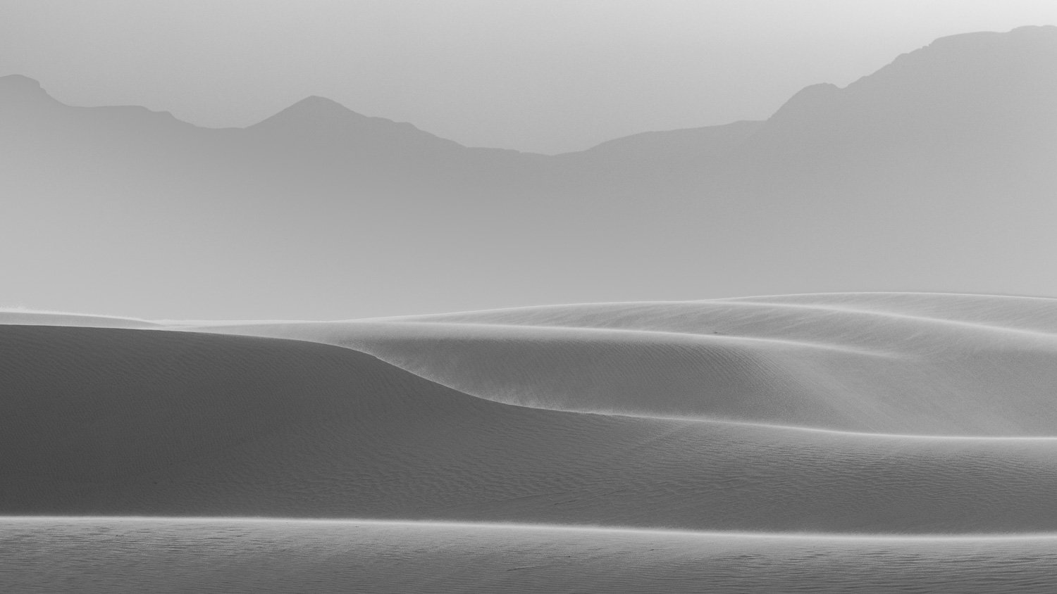
On the road for a couple weeks with Chance. We are trying something new. Camping in the back of the SUV for several reasons, but mainly for ease of stopping for one night and not having to set up and tear down a tent. We had a perfect site for our first night where we could look out the window over to the sand dunes in the distance and Orion working his way across the sky. We got up in the moonlight before dawn to walk out unto the dunes.

Great Sand Dunes National Park, Colorado — moonlit

The winds removed any traces of footprints overnight. In this place, it looked as if were on the sea.

Dune waves

Walking up the dunes is very slow going—especially trying to breath the thin air at about 8,400 feet elevation. When I had gotten ready to go to sleep, the air mattress was extremely uncomfortable. Then I realized I’d inflated it at home at about 700 feet in elevation. I’m lucky it didn’t explode! I let some air out and was much more comfortable.

Morning begins on the dunes

The sun began to clear the Sangre de Christo mountains that envelope the dunes. The prevailing southwest winds blow the sand from hundreds of miles across the arid land, but drop here not being able to go over the mountains. A stream nearby helps keep the sand here. The highest dunes in the park and in North America—Star Dune rises 755 feet which looks and feels even taller when you’re walking up. We didn’t make it nearly that high.

As the sun rose over the mountains behind, the light began to slowly work down from the highest dunes. The farther, higher ones in a golden glow and the lower, closer dunes still in shadow and lit by the moon and reflecting dawn light. Sublime.

My one previous visit to this park was 39 years and one month earlier. Jane was in graduate school at the University of Denver. Our spring breaks overlapped, and we decided a trip to southern Colorado and northern New Mexico would be in the works. After this dawn, Chance and I got in the car to pick up Jane at the airport in Durango, so she could join us for a few days in southern Colorado and northern New Mexico. One of my favorite images from the trip in 1983 is of Jane sitting on the crest of a dune contemplating the view. There in the dawn light was a fellow traveler contemplating the scene.

River Scars

When I was young, some Sunday mornings after church we’d drive over to a spot on the Indian River and watch the manatees.

West Indian Manatees

I think we mostly called them sea cows, though they are somewhat related to elephants and not bovines. The great risk to them at that time were boat propellers that would cut the slow moving creatures. You’d often see scars where cuts healed. Like the mom and child above, barnacles would grow on their backs and the large flat tails that propel them would collect all sorts of creatures.

Yesterday, I listened to a disturbing story on the radio about manatees in this area. Lawn and farming fertilizers have polluted the water and caused algae blooms. That, along with warming temperatures, have killed off the sea grasses that grow in the Indian River lagoon. The Indian River is, or at least was, one of the most productive estuaries in the country. We’d also watch the dolphin jump, the brown pelican dive for fish, the white pelicans circle to concentrate the fish and scoop them up, and in the winter the River would turn black with thousand of American Coots floating on the water.

If you were lucky, you’d see the rare Pelidolphin.

You can listen to the NPR story here. The story starts at Satellite Beach. We had some friends from the neighboring high school at Satellite Beach and some times we’d launch canoes from their place and camp on the islands in the river. A scar on my forearm reminds me of one of those trips when as a unthinking guy I decided to cut a watermelon while holding it in the crook of my arm—not wanting to put it on the sandy, scorpion-filled ground. The knife cut right through and into my arm. After some panic, I realized it wasn’t a serious cut, but it left me with a reminder I can look at today and I still go camping with that knife but treat it with more care.

In junior high we took a science class field trip to a county park on the river. A friend and I used a seine net to see what creatures we could collect. We got lots of fish and crabs, but the prize catch was a little sting ray who came back to live in an aquarium in our classroom.

The estuary runs 156 miles along the east coast. We lived near the north end. Probably all the guys I canoed with up in Satellite Beach were in the Key Club. The state club sponsored a canoe race at Jonathan Dickinson State Park near the south end of the Indian River. I think we finished in the middle of the pack, but at the end my feet slipped getting out of the canoe and I caught myself with my hands. Unfortunately, my hands found all the oyster shells, so I left lots of blood in the river, and I still look at the scar that runs right under my wedding ring.

My brother got a commercial fishing license, and occasionally I’d join him on a night of fishing on the river. We’d leave near sunset and set out a few hundred yards of gill nets. My favorite memories are watching the incredible colors playing between the clouds and water reflections. After a few hours, we’d pull the nets in, collect the fish, move to a new area, put out the nets again and fall asleep looking at the stars.

The New York Times also ran a story this week on the crisis on the Indian River and the starving manatees. I think of all my memories on this water, and look at those etched into my skin, and morn what we’ve done to this special place.

The Fourth Sign of the Zodiac -- by Mary Oliver

Today starts National Poetry Month—no foolin’. I just listened to a rebroadcast of a 2015 podcast interview with poet Mary Oliver. I mentioned in an earlier post that I only learned about Oliver’s poetry after I read her obituary in 2019. Much of her imagery and metaphor come from her walks in nature and her incredible observation.

If you’d like, you can listen to the entire 49 minute podcast here or if you choose, the entire hour and a half unedited interview which is even better: On Being: About halfway through the interview, she reads her four-part poem The Fourth Sign of the Zodiac written after her encounter with lung cancer. Some excerpts of the poem accompany the images below.

Carlsbad Caverns National Park, New Mexico

The question is,
what will it be like
after the last day?
Will I float
into the sky
or will I fray
within the earth or a river—
remembering nothing?

from Part 2, The Fourth Sign of the Zodiac, Mary Oliver

The main reason to visit this park, of course, is the cavern. The second reason is to experience the whir of thousands of bats swarming out of the cave at dusk, some zooming a few feet over your head. An unexpected bonus of the park was walking through the Chihauhaun desert. In the image above, we were blessed with a striking setting sun over the Permian Basin.

Moonrise, White Sands National Park, New Mexico

I know, you never intended to be in this world.
But you’re in it all the same.

so why not get started immediately.

I mean, belonging to it.
There is so much to admire, to weep over.

And to write music or poems about.

Bless the feet that take you to and fro.

from Part 3, The Fourth Sign of the Zodiac, Mary Oliver

The fierce wind the evening pictured above at White Sands blew sand into your clothes. The wind began to settle a bit as the sun set. On a distant dune, three people sat to watch the moon rise in the sky.

Purple Sand Verbena, White Sands National Park

The Purple Sand Verbena is a desert member of the Four O’Clock family. Natives used it as a sedative to reduce nervousness, anxiety, and tension. I suppose that is from consuming it. Seems like just looking at it can have a similar effect.

Late yesterday afternoon, in the heat,
all the fragile blue flowers in bloom
in the shrubs in the yard next door had
tumbled from the shrubs and lay
wrinkled and fading in the grass. But
this morning the shrubs were full of
the blue flowers again. There wasn’t
a single one on the grass. How, I
wondered, did they roll back up to
the branches, that fiercely wanting,
as we all do, just a little more of
life?

Part 4, The Fourth Sign of the Zodiac, Mary Oliver

If you’d like to hear Oliver read the entire poem—and I encourage it—you can find it here. Or you can read it here. And an interpretive footnote—Keats was 29 when he died.

Cherrio

Two years ago, my photo excursion was to leave Isle of Skye and head from the Inner Hebrides to the Outer Hebrides.

Elgol, Isle of Skye

Instead to heading to the remote island of Lewis and Harris, the restrictions in the UK were tightening and my traveling companions from Australia got notice that they had to return to their country. So we returned to the mainland, traveling through Glen Shiel.

Glen Shiel

The Five Sisters of Kintail are the mountain ridge on the north side of the Glen which are Munros, or mountains with peaks over 3,000 kilometers high. As we pulled over to take in this view, I remember seeing a pair of plastic gloves thrown on the ground. The first of a new type of trash of gloves and then facemasks that would litter the ground for the next two years.

Kiltain mountain ridge

Our final road stop was Invermoriston, a small village on the river Moriston as it flows into Loch Ness. The sun was just going behind the mountains and fog rolled in. We made plans that we would redo the photo excursion the following March.

Above Invermoriston

In Edinburgh, I met up with Caroline. We took a last walk through the now empty streets of the capitol city to the view at Calton Hill over to the Castle. The return trip for March 2021 was rescheduled to March 2022, and as Omicron spread, that too was cancelled. So this week, I again should be returning from Scotland. Hopefully, one day.

Sunset Edinburgh from Calton Hill

Thermophilia

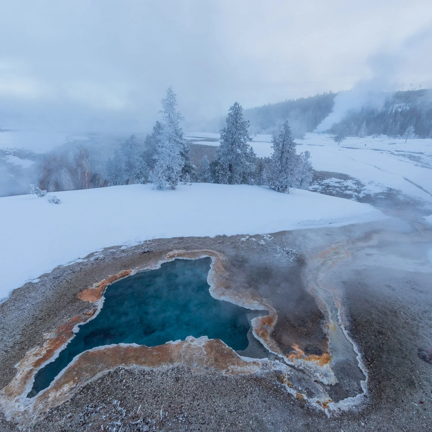
Here’s a continuing celebration of Yellowstone’s 150th anniversary this month of it’s establishment as the world’s first national park. Of all the incredible wonders of the park, I find the thermal features the most compelling. First, two images from a summer visit in 2003. This is Castle Geyser which has a huge geyser cone which may be thousands of years old. One speculation is that there were trees growing here when the geyser first formed and the cone began to build over the trees.

Castle Geyser

Castle and Old Faithful are in the Upper Geyser Basin which has over 150 geysers in a square mile—the highest concentration of geysers in the world. Here is sunset on the basin.

Upper Geyser Basin sunset

Let’s go to the opposite time of day in the opposite season—dawn in winter. This is a 20 second exposure well before sunrise, so you’re seeing a lot of flow of the steam in the wind.

Upper Geyser Basin dawn

Thermophilia means heat loving. The thermophylic communities in Yellowstone are the bacteria, viruses, plants and other life that grow in the hot water pouring off the thermal features. Firehole River flows through several geyser basins on its way to the Madison River. Due to the hot water constantly filling the river, it flows unfrozen through the deepest winter cold. Here, the color of a thermophylic mat shows off as a hot spring runs off into the river.

Firehole River

These colors are most intense in the hot springs. The bands of color form because of the different temperatures in the water and the different life that grows in the varying temperatures.

West Thumb Hot Spring

The West Thumb geyser basin is on the shore of Lake Yellowstone, the largest high elevation lake on the continent. The north part of the lake was formed by the huge volcanic caldera. This southern portion was carved by Ice Age glaciers. Here you can see a hot spring rising at the edge of the lake, and some small animal’s footprints crossing over.

Lake Yellowstone at West Thumb

We’ll end with the third thermal feature which are fumaroles or steam vents which constantly emit steam especially visible in the winter.

West Thumb Geyser Basin

National Parks -- Above and Below

My long legs prefer aisle seats. However, if the flight might be over an interesting area and the light might be good, I’ll get a window seat. I’ve been fortunate several times to go over amazing sights and even recognize the the areas below. Some have been over national parks I’ve visited. Here are images of those parks from above and below. First, looking at the north rim of the Grand Canyon:

A few years later I was visiting parks along the Arizona-Utah border. I was not planning to go to the Grand Canyon. However, I realized I’d never been to the North Rim of the Canyon, I had finished visiting the area I wanted that day and I could get to the canyon around sunset and the clouds looked promising, so I gave it a shot. I was rewarded with an amazing show.

The flight over the Grand Canyon was heading to Hawaii. We took a trip to the Big Island and the flight back to Oahu showed the peak of Mauna Kea, its observatory, and Mauna Loa steaming in the distance.

That morning we had an amazing hike at Hawaii Volcanos National Park which sits under the clouds in the image above on the shoulder of Mauna Kea. In 1959 Kilauea erupted and filled the crater with lava. You can now hike the Kilauea Iki trail down from the rain forest that sits on the rim and then across that barren, craggy crater which steams as rainwater works its way down to the lava that is still cooling off. Meanwhile Kilauea erupts in the distance.

The return flight to Oahu flew over Pearl Harbor. The perspective that the Japanese attack had is quite stirring. You can see the Arizona Memorial.

A few days before we toured the USS Missouri and the deck where the Japanese surrendered and which now overlooks the USS Arizona Memorial where the war started over four years earlier.

Thanks to John D. Rockefeller who donated much of the land that is now Grand Teton National Park (including his airstrip), the Jackson Hole airport sits in the middle of the park. The flight out provides a great view of the park.

This flight was clear. A couple days before, the view from the ground offered the peak of Grand Teton peaking through the clouds.

That flight out of Jackson Hole to Chicago was mostly over farmland and the Great Plains, but then one thing rose out of the flat land—Devils Tower National Monument.

The view from below is impressive, but the monolith seems to stand out even more impressively when seen from above.

The city of St. George, Utah sits just southwest of Zion National Park. This flight out of St. George went right over the park and a feature called Checkerboard Mesa. If you look carefully, you can see the park road running along the base of the Mesa.

The feature that gives Checkerboard Mesa its name is the striking crosshatched design that cuts the sandstone which is enhanced even more with snow. Hope you enjoyed the flights!

West Coast

While looking at some old pictures, I realized it’s been a long while since I’ve been on the Pacific coast. Here’s revisiting the west coast starting at sunset in southern California.

Sunset, Morro Bay, California

An ancient volcanic plug sits just off the shore. The local Salinan and Chumash tribes consider the rock a sacred place. It was once mined to build the nearby harbor, but now in respect to the tribes, no one is allowed to climb it. We were lucky to see it shrouded in coastal fog.

Morro Rock State Preserve

Moving way up the coast, the Strait of Juan de Fuca separates the Olympic Peninsula of Washington State and Vancouver Island of British Columbia. Here it is at low tide.

Pillar Point Recreation Area, Washington

This was from a trip shortly after my uncle Ed’s death. My aunt Fran died a few years earlier, and I had asked Ed where Fran was buried. He simply pointed out to the Strait. It resonated with me, since our last visit with Aunt Fran included a ferry ride across the Strait to Victoria, B.C. So a bit of Fran is in the power of the waves.

Strait of Juan de Fuca, Washington

Eleven years ago, my son Dan and I had some photo fun along the Oregon coast. One of the iconic places we visited are the sea stacks at Bandon Beach.

Bandon Beach, Oregon

Part of the fun revisiting these old images is working with them with new processing skills I’ve learned since taking the images and improved software. This was another of the iconic Oregon sea stacks about 250 miles north of Bandon Beach and a visit for another sunset. Thanks for joining me on this trip back up the coast.

Sunset, Cannon Beach, Oregon

Dangerous Beauty

You’ve joined me on this hike before on the Paul Douglas/Miller Woods trail in Indiana Dunes National Park. It snowed last Thursday, so it looked promising for a hike here Friday morning. The trail starts along a couple beaver ponds and then heads into the Black Oak Savanna.

Beaver pond and Black Oak Savanna

Before colonial settlement, 50 million acres of oak savanna extended from Michigan to Nebraska. Natural fire and controlled burns by Native Americans maintained this valuable ecosystem of prairie grasses among sparse, fire-resistant oaks. Only about 30,000 acres remain, and Indiana Dunes protects some of the largest and best of this habitat.

The trail continues up and down the inland dunes with ponds between the dunes. You then cross the Grand Calumet River before getting to the dunes along the shore. Some ice and snow on the river seems to point the way.

There had been strong winds with the snow. This made hiking interesting. It was easy walking in the few inches of snow, but you couldn't tell where the snow had blown into deep patches. Even more confusing, the sand would blow on top of the snow making you think you'd step on sand,

You’d step on what looked like sand and then be surprised when your feet sank in a foot of snow.

The patterns blown in the snow and sand were mesmerizing.

After crossing the final dunes, you arrive at the beach and the lake beyond. The beach was covered with a thin coat of ice 50 to a 100 feet wide, and it seemed ice bergs and islands floated along the beach.

Where sand met lake, waves crashed and built ever higher shelf ice. I can't deny the strong urge to climb the shelf ice to see the forms and waves on the other side, but it is not safe to do so. You don't know how solid the ice is below or where you might slip. So we enjoyed the view from the shore.

On Monday, five young men hiked on West Beach near here and went up on the shelf ice. The weather had warmed over the weekend. The ice was cracking.

A twenty-two year old who had just moved to the area fell into the water. Apparently, the friends grabbed his arm, but the waves and unstable ice pulled him away. The search continues.

Misty Days

I’ve shared some verse before of Joy Harjo, the first Native person to serve as the U.S. Poet Laureate and is in her second term. Here are excerpts from two poems from her 2015 book Conflict Resolution for Holy Beings. Accompanied by (with one exception) images from the southeast U.S. where her Muscogee (Creek or Mvskokvlke) people lived.

Big South Fork National River and Recreation Area, Kentucky

Forever (a song)

In the night of memory

There is a mist

In the mist is a house.

It’s the heart where we lived.

. . . .

East Rim Overlook, Big South Fork NRRA

Once I was broken by time.

There was no house in the mist.

I lost sunrise. I lost your fire against mine.

A country was falling and falling.

. . . .

Newfound Gap, Great Smoky Mountains National Park

I crossed time to the house in the mist.

It is not any house; it’s the heart where we live.

. . . .

from Forever (a song), Joy Harjo in Conflict Resolution for Holy Beings, 2015

(the link is to the entire poem)

And now, excerpts from Surfing Canoes

White Sands National Park, New Mexico

We’ve felt the winds surf the waves

Alongside the canoe

This is where joy lives

Pisgah National Forest, North Carolina

This moment of earth breath

Lifting up with us

Letting us go with us

. . . .

From, Surfing Canoes, Joy Harjo in Conflict Resolution for Holy Beings, 2015

Cumberland Trail, Obed National Wild and Scenic River, Tennessee

One more image, and bit about history. I’ve driven I-75 near Macon, Georgia dozens of times on trips between Florida and Illinois. A couple years ago, for the first time I pulled off to visit nearby Ocmulgee National Historic Site and was gob smacked by the ancient mound builder site that is a spiritual location for the Muscogee (Creek) Nation. This week, the National Park Service announced a purchase and donation to double the size of the park. Humans inhabited this area for 17,000 years, and it is the largest archeologic dig in U.S. history. The Muscogee (Creek) lived here until they were removed to Oklahoma in 1826 by the Treaty of Washington.

Great Temple Mound, Ocmulgee National Historic Site, Georgia

Snowy Days

Winter walks at nearby parks while the snow is falling.

Mayslake Forest Preserve was originally the estate of coal baron Francis Peabody. In 1922, a year after completion of the Tudor mansion there, he died of a heart attack on a fox hunt on the property. The family sold the estate to the Franciscans who made the property a retreat center. DuPage County purchased the property in 1992. We frequently attend plays in the old mansion, enjoy the dog park, and walk the trails through the woods and prairie. The Franciscans had a Way of the Cross wind through the property, and many of the crosses are still found through the grounds.

I chatted with a volunteer this fall gathering prairie plant seeds. In the 30 years the county has owned the property, the diversity of the prairie has exploded. While the plants show off through the spring to fall, a few stark remnants remain in winter.

Or you can simply take a chance to run in the snow.

Further down the coast

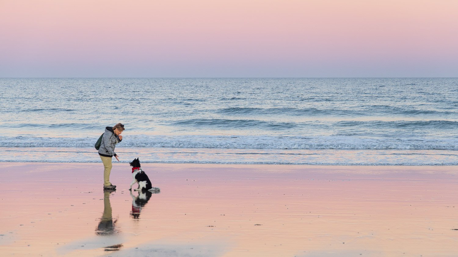
The beach closest to where I grew up in Florida is nothing like the Maine coast. No rocks, boulders, or dramatic coves. Simply, a featureless sandy beach as far as you can see north and south, and looking east, a palette that changes day to day.

Since the beach faces east, the color—if it will be there—comes in the morning. Fortunately, in late January, the dawn does not come too early. This January day three years ago started with crazy colors before the sun got to the horizon.

The colors only seemed to intensify as the sun got ready to peek out. And when it did, the range of colors settled down to only a few.

Gulls and skimmers did their feeding, and played in the light.

A few mornings later, the sky was clearer. The early dawn showed the crescent moon and three planets.

And the palette of colors would be more subdued. Florida has no mountains, so the clouds offer their height.

Another day had a foggy glow with rich color.

And the color floated over the water.

The Ocean From Which We Came

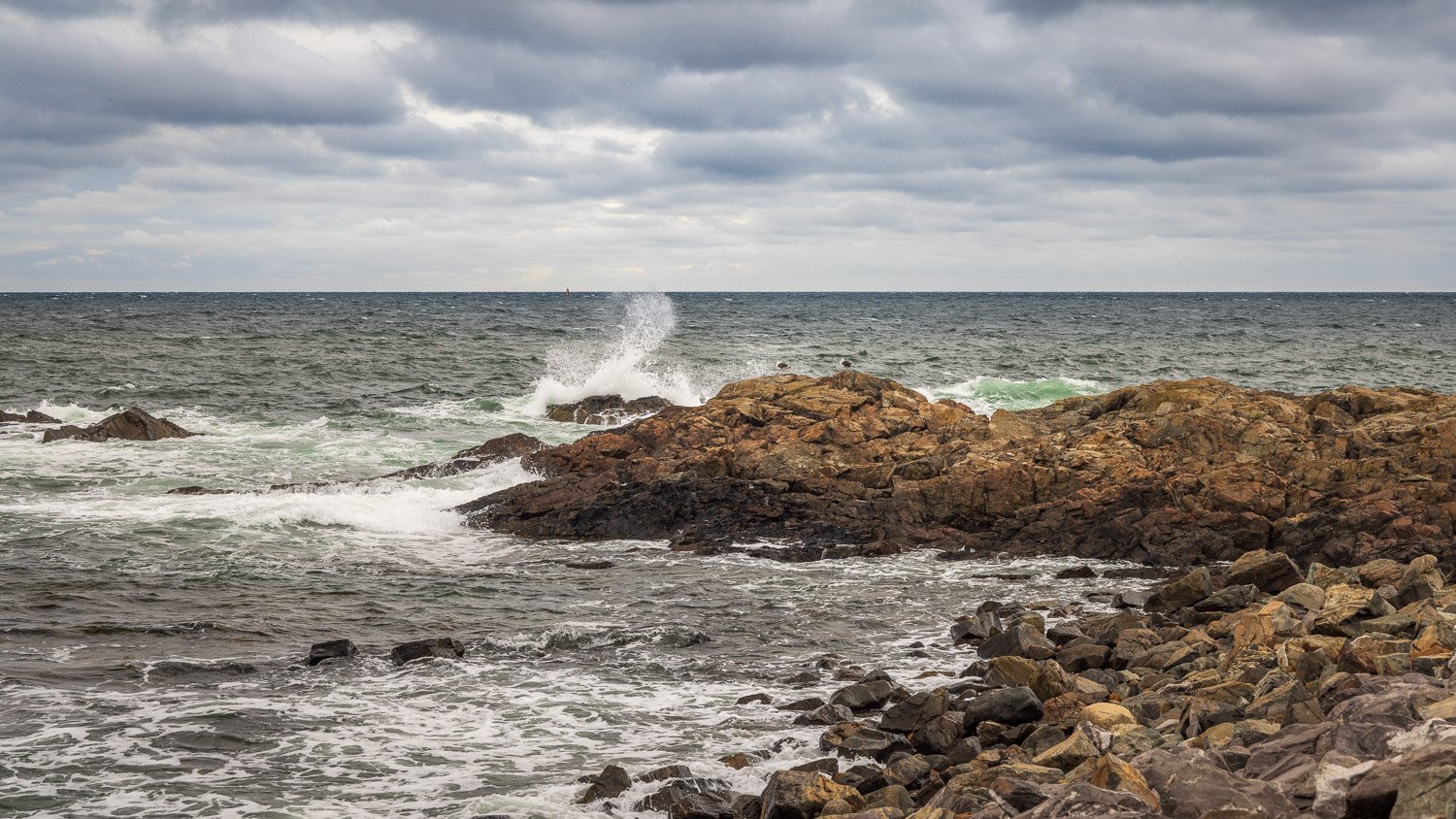
The Maine beaches were generally moody and overcast on our visit in October.

Wells Beach, Maine

The poet Mary Oliver frequently used shore imagery. She lived much of her life near the Massachusetts coast. Here’s her poem The Poet Compares Human Nature To The Ocean From Which We Came.

The sea can do craziness, it can do smooth,

it can lies down like silk breathing

. . .

Silky - Wells Beach, Maine

. . .

or toss havoc shoreward; it can give

. . .

Toss havoc - on The Marginal Way

. . .

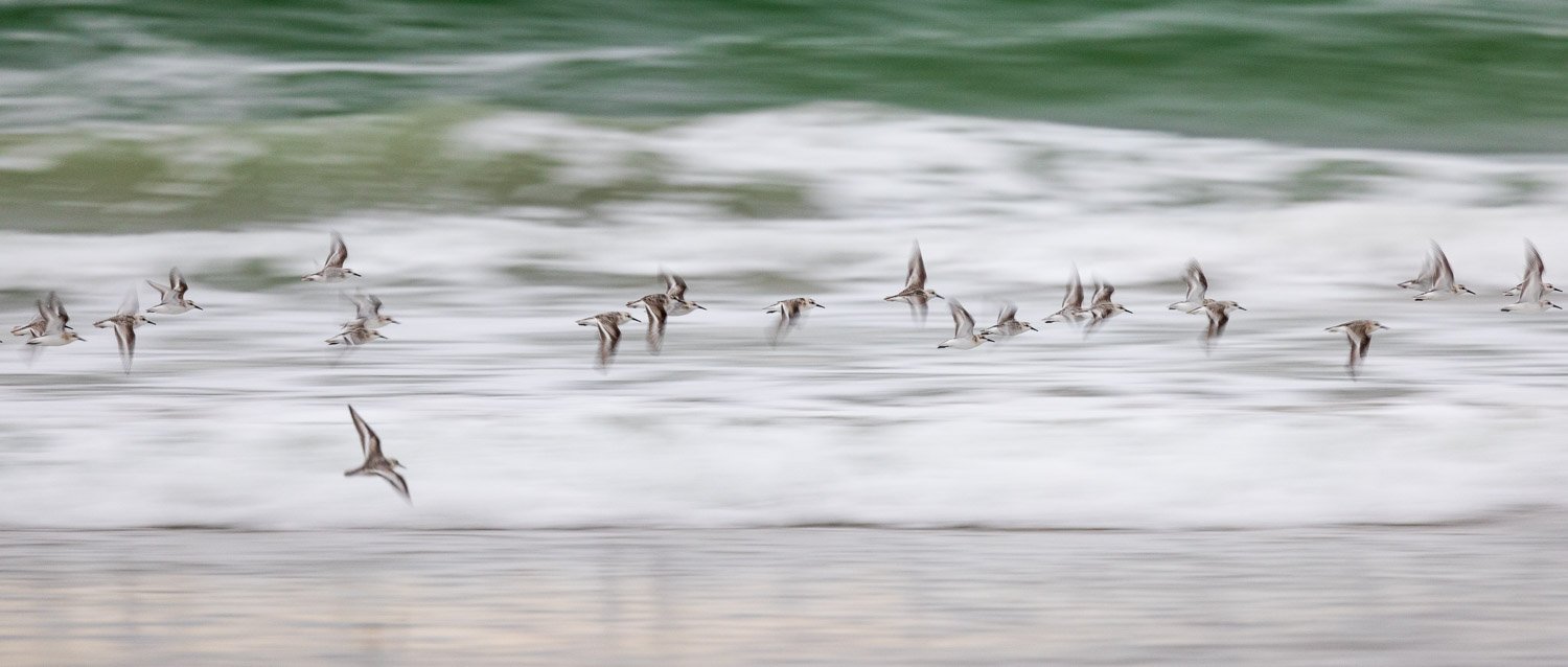
gifts or withhold all; it can rise, ebb, froth

. . .

Sanderlings in flight - froth

. . .

like an incoming frenzy of fountains, or it can

. . .

Fountains — The Marginal Way, Ogunquit, Maine

. . .

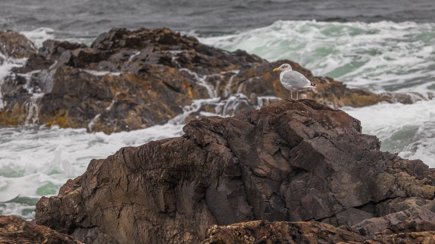
sweet-talk entirely. As I can too,

. . .

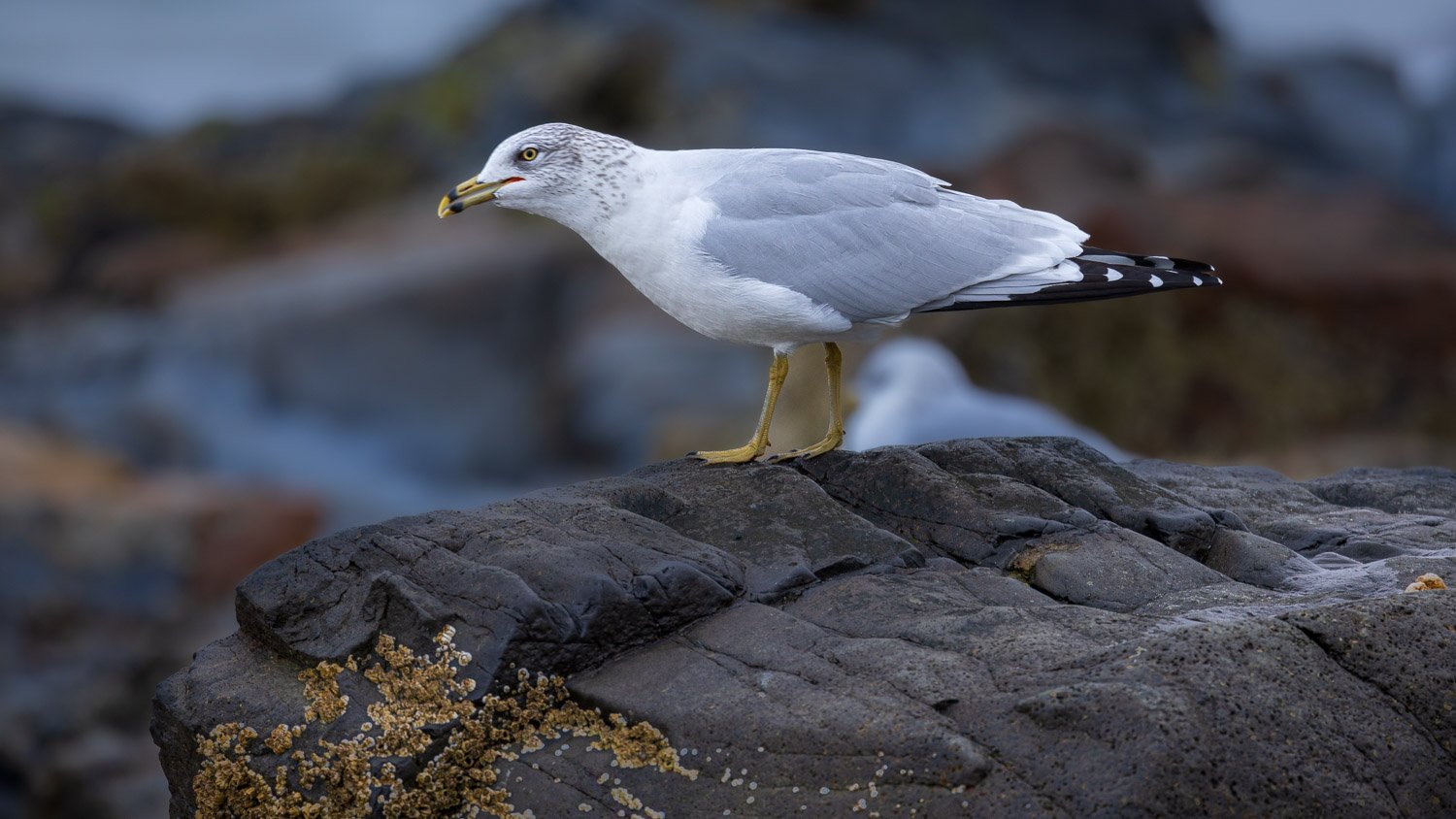
Ring-billed Gull sweet talking

. . .

and so, no doubt, can you, and you.

Mary Oliver, The Poet Compares Human Nature To The Ocean From Which We Came, from A Thousand Mornings, 2012

On the Marginal Way, Ogunquit, Maine

Fungus Among Us

Making dinner tonight, I was thinking about what I might focus on for the Friday Foto post. I was chopping up some mushrooms for pasta, and thought, “Well, mushrooms.” There were so many mushrooms on hikes I took this year, I was sure I’d find plenty of images.

Cabbage Palm, moss and lichen

But let’s start where I got an early education on biology—in the Erna Nixon Hammock where I’d take walks as young boy. Mrs. Nixon would point out the patches of brilliant red-blanket lichen and talk about symbiosis. How fungus and algae join together to make a different life form—lichens. And in the case of some lichens such as red-blanket, bacteria is thrown in the mix. From the Arctic to mountain tops to deserts to wetlands, lichens range all over the Earth.

Red-blanket lichen

Fungus and lichen paint many trees and rocks offering color and texture to places that might otherwise be very plain.

A final image from the hammock in Florida before we move north starts our views of mushrooms, and their great color and shapes.

At Erna Nixon Hammock

Next stop, another of my favorite places, Starved Rock State Park in Illinois.

Illinois canyon

The last two images were of fungus growing on logs laying on the ground. The next image is looking up high on a tree in a forest preserve in Cook County, Illinois.

Moving much farther east. We hiked on a trail just outside Portland, Maine and I don’t think we’ve ever seen so many and so many different types of mushrooms. According to wikipedia, 148,000 types of fungus have been identified, although there are an estimated total 2.2 to 3.8 million species in the Kingdom Fungi. Here’s one.

And the trails in Tennessee were filled with colorful members of the Kingdom Fungi.

At Obed National and Scenic River

Hope you found these fun to look at. The ones for dinner were very tasty!

A narrow venture with Leslie Marmon Silko

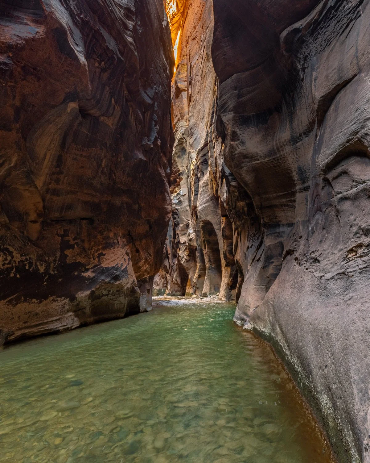
Two years ago this week, the rest of my family travelers ventured back home. I stayed on for a few more days in southeast Utah. One of my plans was to hike up the Narrows, which is the top of the main valley canyon in Zion National Park. The Virgin River cuts a narrow canyon through the sandstone until it opens up into the wider valley that is the main destination in this third most visited national park.

This is a very popular hike, with summertime photos showing scores of people walking through the cold water on desert hot days. But midweek on a January morning wrapped in waders and neoprene boots, I was alone in the canyon.

The year before I started law school, I worked as a messenger for a law firm and hiked the canyons in downtown Chicago every day. One of my frequent stops was the MacArthur Foundation which was just getting started after the death of John D. MacArthur a couple years before. One of the first recipients of a MacArthur Foundation Grant was Leslie Marmon Silko of the Laguna Pueblo people. From her poem, Where Mountain Lion Lay Down with Deer:

I climb the black rock mountain

stepping from day to day

silently.

. . . .

. . .

The old ones who remember me are gone

the old songs are all forgotten

and the story of my birth.

. . .

How I swam away

in freezing mountain water

narrow mossy canyon tumbling down

out of the mountain

out of deep canyon stone

down

the memory

spilling out

into the world.

From, Where Mountain Lion Lay Down with Deer, Leslie Marmon Silko

from Long Time Ago

. . . .

At first they all laughed

but this witch said

Okay

go ahead

laugh if you want to

but as I tell the story

it will begin to happen.

. . . .

Then they grow away from the earth

then they grow away from the sun

then they grow away from the plants and animals.

They see no life.

When they look they see only objects.

The world is a dead thing for them

the trees and rivers are not alive.

The deer and the bear are objects.

They see no life.

They fear

they fear the world.

They destroy what they fear.

They fear themselves.

. . . .

From, Long Time Ago, Leslie Marmon Silko

2021 -- For the Birds

I hope everyone reflecting on 2021 finds some jewels among the continuing challenges. Our lives continue to challenge our fellow creatures, in particular the birds. This refuge of Bosque del Apache does provide a wintering home for many birds beyond the cranes and snow geese who are the showstoppers. Here’s a few of the others spotted.

Gambel’s Quail

This was one fellow I definitely wanted to meet on my visit to Bosque. They did not disappoint in their charismatic scurrying along the ground. What did surprise me was their delightful noises of clucking, chuckling and calling out to each other. The strangest sound was like water drops falling through the desert brush they were in.

Brewer’s Sparrow

Another to add to my life list were these Brewer’s sparrows that buzzed and sang along many trails at the refuge.

Lesser Goldfinch

These little cousins to the American Goldfinch played around a feeder quite a bit, but this fellow found a nice branch to pose on while pausing between feedings.

Pyrrhuloxia

Along with the Gambel’s quail, this was the bird I was most hoping to see. The Pyrrhuloxia is the desert version of the Cardinal. Mostly in Mexico and south Texas, New Mexico is the northern area of their range, and I was lucky to spot a couple and this lady posed nicely on a cactus.

Blackbirds

The geese weren’t the only ones flying around in large flocks. Murmuration’s of blackbirds would swoop through the marshes and fields as well.

Northern Pintail

The lady in the background seemed a bit impressed as this male Northern Pintail showed off some of his elegant plumage.

Cooper’s Hawk

Plenty of birds of prey patrolled the skies. Northern Harriers teased me throughout my visit, seeming to choose to fly near me as I was driving, and then fly off as soon as I stopped my car, so I got a lot of images of harrier tail feathers. I really wanted to get a picture of a Golden Eagle. I finally saw one just a few feet away eating a deer. Unfortunately, the deer was roadkill and I was going about 75 mph. This Cooper’s hawk perched nearby with a nice view and I kept encouraging him to seek some prey so I could get some flight shots, but his patience in the tree outlasted mine on the ground.

Bald Eagles

Several bald eagles kept watch around Bosque. I don’t know if they were just easier to spot on these snags or they really preferred them, but there was nearly always at least one to found on these large dead trees in the middle of marshes.

Pelican, cranes and ducks

As I was ready to leave Bosque del Apache National Wildlife Refuge, I drove by this pond hoping to enjoy the last of the low morning light on some cranes or geese. I noticed this cluster of white birds on the north end of the pond. As I drove closer I was surprised they were not snow geese but a cluster of white pelicans. Growing up in Florida I’d watch white pelican fish forming a large circle in the water and then slowly contracting the circle and concentrating the fish. They’d fill their pouches with fish. I’m still surprised when I see pelicans with mountains in the background. This was a fitting scene to leave imprinted on my memory as I left Bosque. Hoping the new year brings you many scenes of peace and life, and may 2022 be a good year for the birds as well.

First Light in New Mexico

This is why I came back.

The blast off at Bosque del Apache National Wildlife Refuge.

To get there in the dark. As the sky lightens, to hear the geese talking joined by the calls of ducks and cranes. Suddenly, the geese talk gets very loud. Thousands of wings beat. The geese take off, and a thunder of wings and squawks go overhead.

But. What will the light be? Will the temperatures be in the single digits, freezing as you wait and wondering if your fingers will work to push buttons? And when the geese decide what they’ll do—a few minutes before sunrise, a few minutes after, will they blast off, or will they just stay put. Two mornings in New Mexico. What will it be?

Bosque del Apache dawn

December 1, 6:28 a.m., a half hour before sunrise a few hundred snow geese fly in to join others already in the water. The wildlife refuge staff flood certain areas where the geese and cranes will gather for the night. This long pond runs north and south, and photographers are lined up tripod leg to tripod leg looking east to the dawn sky. I’d gotten a tip that the birds were having a tendency to gather at the north end of the pond, so I set up there. This group flew in and things quieted down. Then eleven minutes later, the geese calls got very loud. Get ready!

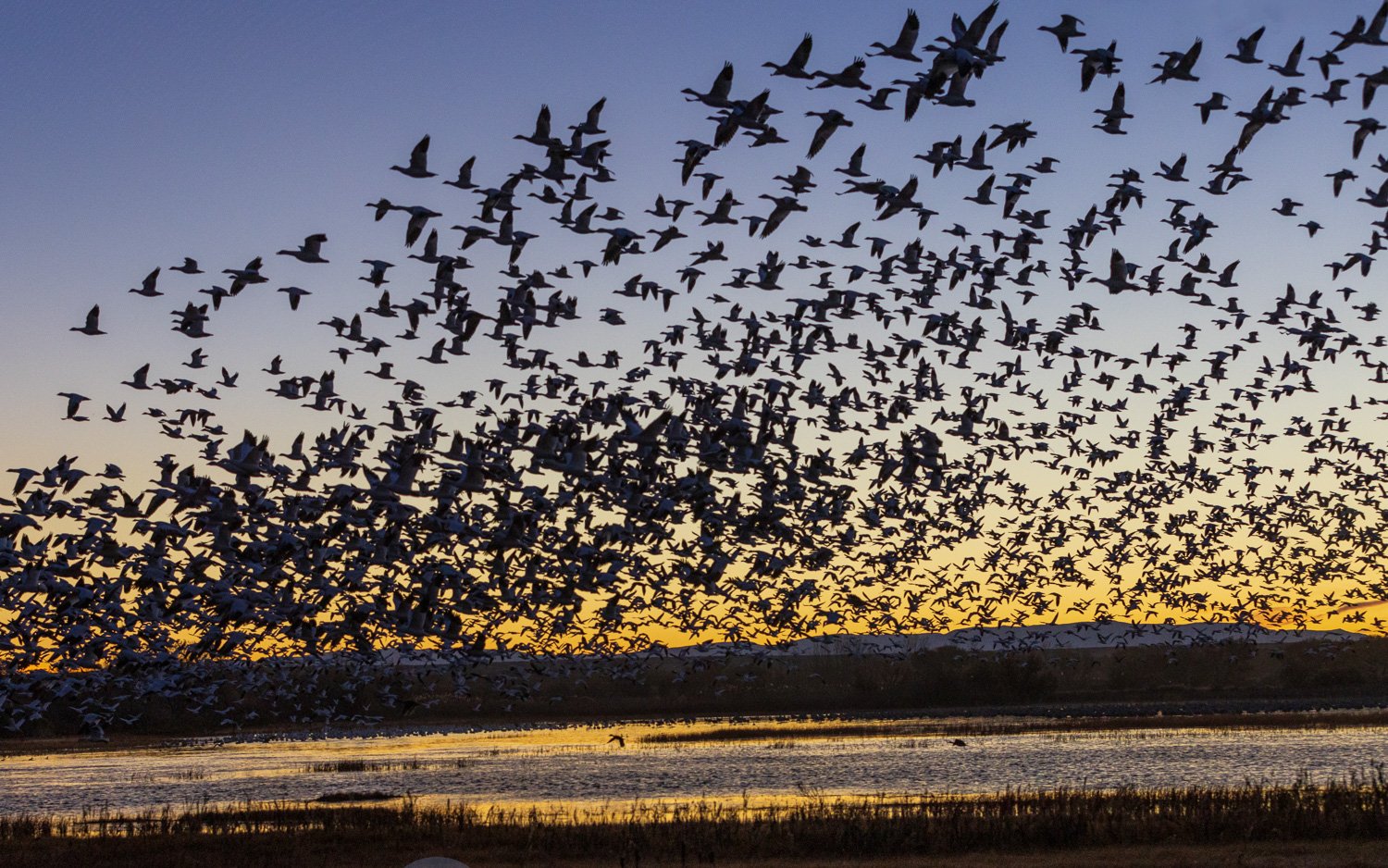
Snow Geese blast off

6:39:36 the blast off begins, and you hope your camera settings and you are ready to capture the show.

6:39:43 all the geese have left the water. The sky thunders with wing beats and honks.

6:39:49 the snow geese have all taken off and are heading north out into the fields for the day. In about a half minute the pond has emptied of thousands of geese with only their reflections in the water and they’ve gone overhead with calls fading into the distance. Time to search out more opportunities as the sun gets ready to rise, so walk further south and spot some sandhill cranes in the water.

Sandhill Cranes in dawn light

The soft dawn light was pushed aside as the sun got over the San Pascual mountains, and a different kind of magic began. And look, a few snow geese were still around.

Snow geese trio

The Sandhill Cranes don’t blast off in the large groups like the geese, but often leave in small family groups of two to four birds. They’ll often tip off when they’re ready to leave by stretching out their necks and leaning in the wind.

The cranes ended the morning light show as they, too, took off to surrounding fields.

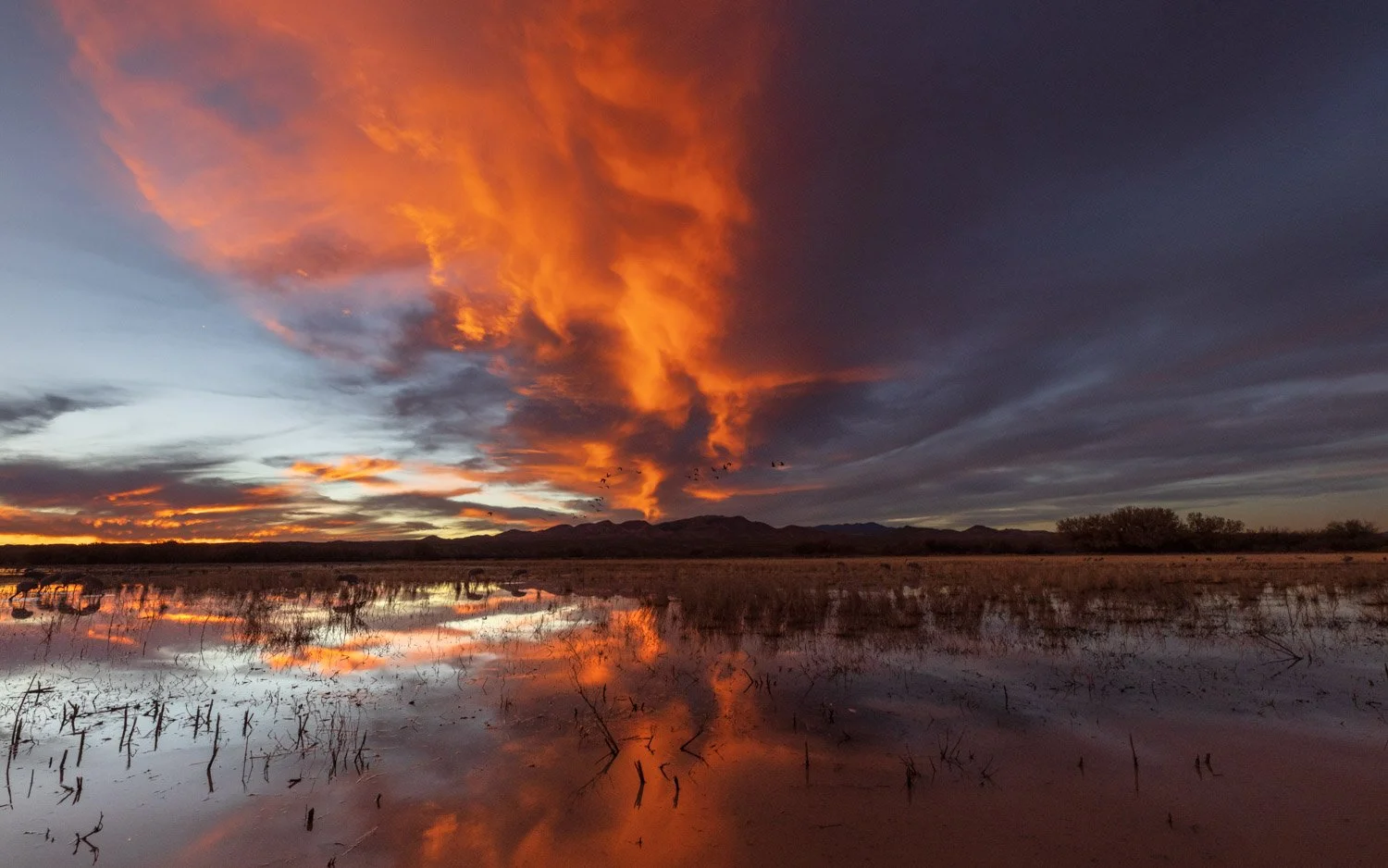
The morning sky was pretty clear with a few clouds near the eastern horizon to add some color. That evening the clouds moved in, and as last week’s post showed, the sky put on quite a show. What would the next morning bring? I got to the location a bit earlier with hopes of getting the crescent moon near the horizon. About an hour before sunrise, the sky began to light with nice color in clouds.

At 6:23, still 35 minutes before sunrise, the geese honking got loud, and here they came.

Is this the blast off already? The geese seem to circle around.

Instead of taking off and scattering through the surrounding area, the geese were gathering in the pond. Soon enough, the sky was emptied of birds and the pond was filled with geese.

Dawn over the San Pascual mountains

Unlike the day before, there would be no big blast off the geese. Large numbers of geese would start honking loudly, and a group of a few hundred geese would take off.

Seven minutes until sunrise

At 7 o’clock, the sun got over the distant mountains, and groups of geese continued to go. Two very different and exceptional mornings at Bosque del Apache.

Sunrise, Bosque del Apache National Wildlife Refuge, New Mexico

The Last Half Hour of Light in New Mexico

Bosque del Apache National Wildlife Refuge lies in the Rio Grande valley in west central New Mexico. For eons rain flowed down the mountains into the valley to the river. Monsoons would flood the river and new channels would form. The old river beds and wetlands supported wildlife and was a corridor for migrating birds. Some would spend the winter in the Bosque area.

Ten minutes to sunset:

Sandhill cranes over Chupadera Mountains

For thousands of years native tribes hunted, farmed, and lived in the valley and each year the birds returned. New settlers could not live with a river that flooded and changed its course. So the river was dammed, irrigation canals were dug, and the river was tamed. Wetlands disappeared, food for the birds was gone and the birds, too, began to disappear.

Sandhill crane and cottonwood

In the 1930s, giving jobs to young men who were devastated by the Depression, the Civilian Conservation Corps began restoring the floodplains in the Bosque del Apache. In 1939, President Roosevelt signed legislation protecting over 57,000 thousand acres and adding Bosque to the U.S. Fish and Wildlife Service’s National Wildlife Refuge system. Birds began to return.

Bosque del Apache is one of over 500 national wildlife refuges managed by the Department of Interior. Staff regulate gates and ditches to mimic the seasonal flooding of wetlands. Water moves through fields, marshes and ponds and back to the Rio Grande. Invasive plants are removed, and natural food sources such as millet and chufa are returned, and other grain crops are grown. The flooded areas are nighttime homes for thousands of sandhill cranes, snow and ross’s geese, in part to protect them from coyote and other predators.

Sunset:

Sandhills may be the oldest living birds with 2.5 million year old fossils nearly identical to the current species. While they eat mainly grains and vegetation, they are omnivores and will happily take on insects, amphibians or small mammals. A young bird near me once pulled a mole out of the ground and had quiet a struggle getting it down, but eventually was successful. Though some subspecies stay year round in Florida, Mississippi and Cuba, most migrate to and from the Arctic. Pictured here are those part of the western flyway. I live under the eastern flyway, and as I prepare these images I heard a couple groups heading south even this late in the year. Their ancient call is remarkable, and I can hear it inside the house, and go outside and see them hundreds of feet in the sky.

When the birds begin landing, they usually “balloon” or “parachute” in with feet down, toes spread and wings akimbo. It is as if the nearby petroglyphs have come to life and are falling from the sky.

Desert southwest sunsets and sunrises can be breathtaking, but you need clouds for the colors to explode. I kept checking forecasts for my two mornings and evenings at Bosque, but they kept saying clear skies with the possibility of clouds the second day. The second afternoon skies were clear, but the forecast was for clouds. And they came! Of course, the images so far are with long telephoto lenses. But after the sun set and the colors began to change, it was time to reach into the bag for a wider view.

It can be a bit of a frenzy photographing birds in flight, though sandhills are pretty predictable and relatively slow. A peaceful sunset can be just as frantic capturing the rapidly changing light, searching for compositions, changing perspectives, and getting different lenses. And trying to simply enjoy the majestic scene developing in front of you.

A tough tip to remember during spectacular sunrise and sunset shows is to look behind you. This one lit the sky in all directions. Here’s looking behind where I took the last image.

And back looking the other way again to the most intense colors of the evening.

As the light fades, the birds continue to come from the fields in the surrounding areas where they’ve spent the day. The places with water are rare. The intense drought has continued for a couple years. The staff at Bosque del Apache cannot flood as many fields this year. An interview with Debora Williams, the director of the NWR explains the efforts to maintain the refuge under the challenges of drought. The interview starts at 33 minutes in, but this link might take you directly to that part of the show. Will we confront climate change? Will we invest in infrastructure and jobs like the CCC in the 1930s to enhance lives and the environment?

As the light fades, sandhills continue to parachute in. Time to get the long lens out and concentrate the last of the light. The Friends of Bosque del Apache support the refuge, staff the visitor center and the adjacent desert arboretum from where I’ll share more images. If you’d like to support their efforts, you can donate or purchase raffle tickets for a sandhill crane quilt. The raffle ends today!

Though many birds stay or travel through the refuge year round, the thousands of geese and sandhill cranes (and many turkeys, white pelicans, blackbirds, etc.) concentrate in the refuge from mid-November through January. If you haven’t yet, I hope you have the chance to visit.

New Mexico mammals

Just returned from a trip to New Mexico highlighted by the birds at Bosque del Apache National Wildlife Refuge, but a few mammals showed themselves along the way—not counting the road kill and the Golden Eagle I passed by at 75 mph eating a carcass.

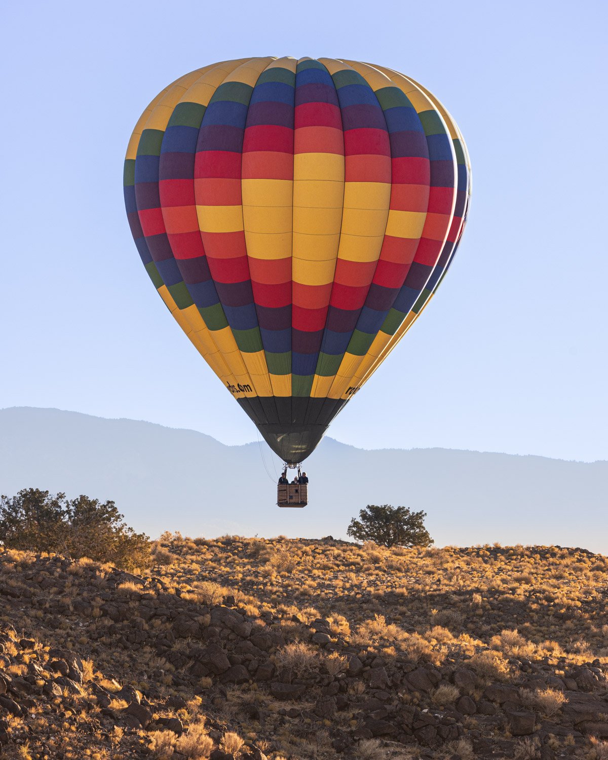
My first morning stop was Petroglyph National Monument in Albuquerque. The park spreads over several areas on the outskirts of the city along a volcanic rift where Ancestral Pueblo people made petroglyphs 400-700 years ago. Most of the units don’t open until 8 or 9 a.m., but Piedras Marcadas Canyon trail stays open. I made it for a great sunrise, and saw some iconic Albuquerque hot air balloons also enjoying the sunrise. This one later came down for a close view of the mesa ridge over the canyon.

The petroglyphs are incised into the lava blocks along the ridge. There are many human and geometric shapes and birds, and some desert animals as well. Some later crosses and cattle brands by Spanish colonists are also found in the rocks.

The petroglyphs are on boulders along the canyon walls. Running among the boulders were some dessert cottontails. They are prey for nearly every predator in the area—hawks, snakes, foxes, bobcats, and the fellow who’ll be in the next image. Hard to see on this image, but the front of this guy’s face showed he had a narrow escape not long before, so he’s showing his speed.

Dessert Cottontail — Petroglyphs National Monument

The mesa ridge overlooks the field of lava boulders. There wandering along the edge was one wily coyote searching for cottontails or similar fare. Unlike the wolf that likely came across the Bering Straight, coyote has ancient American origins. Likely the people who made these petroglyphs told stories of the trickster Coyote.

Near the visitor center at Bosque del Apache NWR are trails through a beautifully tended desert arboretum that has plenty of bird feeders and water sources. I added several birds to my life list in this little area, and was enjoying just sitting listening to the beautiful calls and watching the variety of birds around one feeder. Then this little fellow came up to feed and the birds didn’t seem to care it was sharing the food. This tiny fellow is mouse-sized but called a Hispid Cotton Rat.

Hispid Cotton Rat — Bosque del Apache NWR

Bosque del Apache NWR runs along the banks of the Rio Grande, and is the wintering home of tens of thousands of Sandhill Cranes, Snow Geese, Ross’ Geese, and other bird species. Even in times of severe draught as there is now, the fields and water levels are carefully maintained to provide optimum food sources for the birds. I suspect the mule deer enjoy this abundance, too.

Mule deer — Bosque del Apache NWR

Young buck

The Rio Grande has changed its course over the years. The Rio Viejo trail runs through an old channel of the river. The rich soil supports a large cottonwood forest that still held golden autumn leaves. I heard some rustling and spotted a javelina. They have poor eyesight, so I stopped and knelt down. Soon I noticed a dozen of them were eating their way through the woods. One of the boars crossed the trail near me and took a dump. Though he was about the size of my dog Chance, he impressively left behind several days’ worth of what I need to pick up from Chance. After watching and photographing for a while, I stood up. The startled band thundered away.

Javelina or collared peccary

Feeding Fall Birds

It’s been far too long since I’ve done a post on birds. However, I’ve got a trip planned to focus on some flying feathers. Before we get to that, I’ve been capturing some birds close to home with a new long lens I’m having some fun learning to use. Let’s start with a couple little ones from St. James Farm Forest Preserve in Winfield.

House Finch

This House Finch was singing away on top of the pine. Several Chickadees were flitting through the shrubs gathering seeds, and were a challenge to capture.

Black-capped Chickadee

I was in the back yard watching a Red-tailed Hawk flying overhead. Then it began pursuing a flock of pigeons, so I went in the house to grab my camera. The chase lasted a bit, but I couldn’t get any images. Then another hawk came, and the two tumbled about in the air.

Red-tailed Hawks

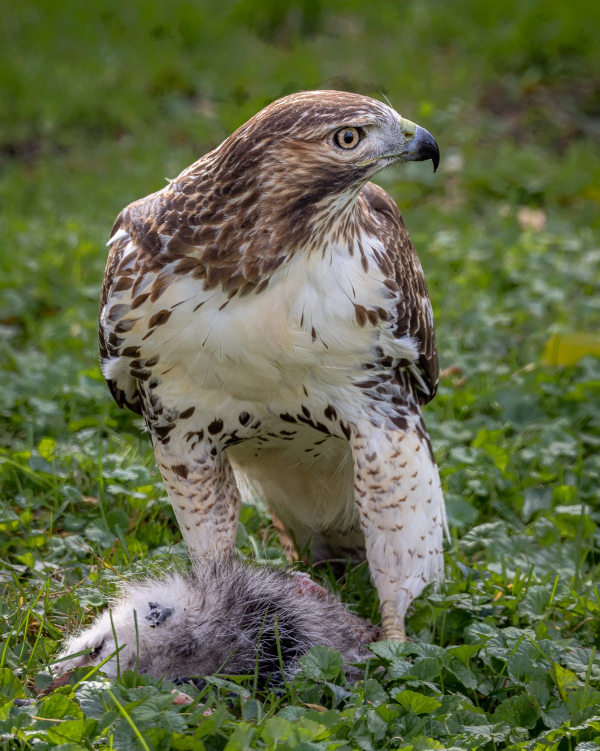
I had the urge to get some more bird images then, so it was time to drive to a nearby forest preserve to see what might be around. As it turned out, I got no images there. But with the long lens next to me, just a couple blocks from home a Red-tailed Hawk was sitting in a parkway having lunch. Could it have been the same hawk that was flying overhead just a little while ago?

Those who might be sensitive to a raptor enjoying its prey should scroll past the next two images of the possum and the hawk.

Red-tailed Hawk and possum

A couple weeks ago, I posted a story about a hike on the Paul Douglas trail at Indiana Dunes National Park. Just as with my first hike there last winter, the beginning of the trail is loaded with woodpeckers. I’ve never seen so many concentrated in one place, including several Red-headed Woodpeckers.

Red-Headed Woodpecker

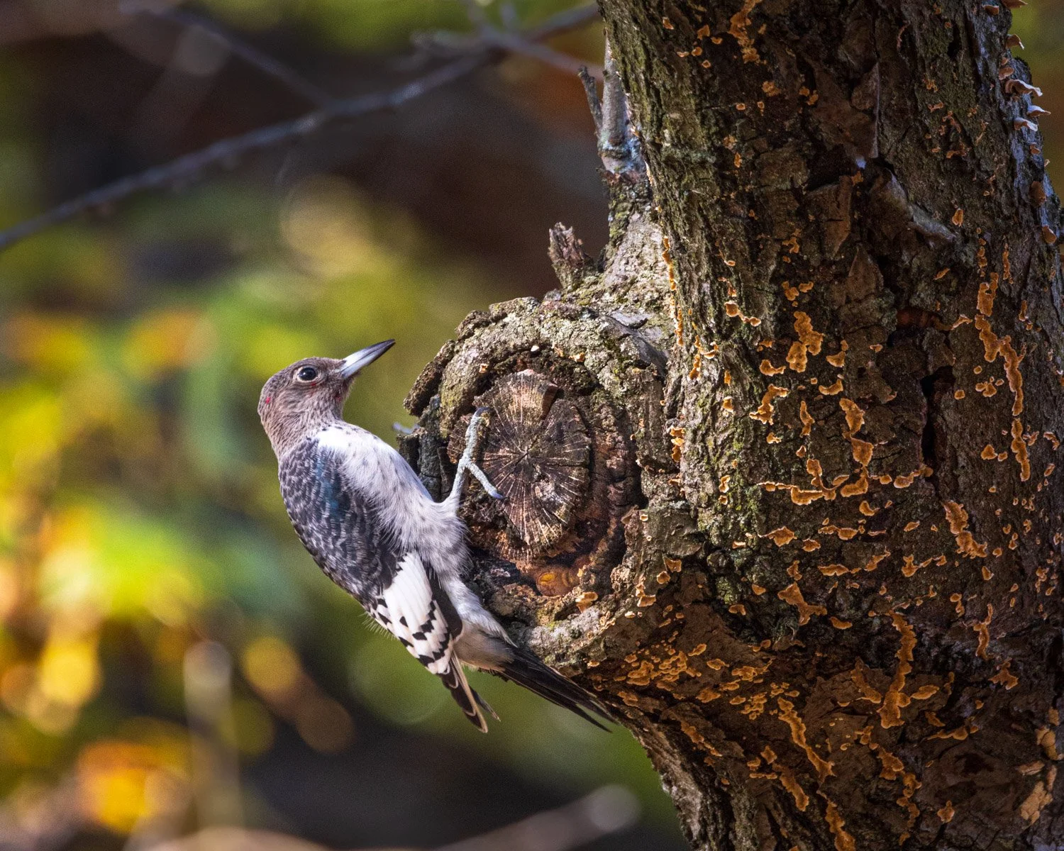
The birds were very busy packing nuts and seeds into crevasses in the trees to get ready for winter. I think the fellow in the next image is a juvenile. You can see one tiny blotch of red starting to feather out on his head. If you look carefully, you can see some of the nuts that he was very busy plugging into the tree.

Seed storing

As I was driving away from the Cowles Bog trail at the Dunes, a pair of Sandhill Cranes were feeding in the marsh. Usually by this time of year, I’ve heard the cranes flying south, but I haven’t heard any so far. However, in a couple weeks, I expect to see thousands of them. I’ll be heading to Bosque del Apache Wildlife Refuge in New Mexico, where I went once before in 2009. Tens of thousands of Cranes, Snow Geese and Ross’ Geese spend the winter there along the Rio Grande. One of the greatest wildlife scenes I’ve experienced is the “blast off” of the geese around sunrise. As the sky begins to light up, the cranes and geese begin to call and honk. Some mornings small groups will take off, but most days something triggers the whole flock to suddenly take flight off to the surrounding fields. The rush of wings swirling overhead is breathtaking.

Local Bosque del Apache groups run a Festival of Cranes the weekend before Thanksgiving, but as last year, it is a remote event. You can attend some of the classes Friday and Saturday if interested. Or you can peek into their live Facebook feed Saturday morning for the fly off—and hopefully blast off—or the sunset return when they fly back to the pond where they spend the night. The morning feed is from 6:45 to 8 a.m. CST. The birds don’t tell you ahead of time when they’ll take off, but usually it’s about 10 minutes before or after sunrise. The evening fly-in spreads out through the evening and the live Facebook feed will from 5:30 to 6:45 p.m. CST. The cranes seem to be calling the entire time. Can’t wait to get there in a couple weeks!

Indiana Dunes National Park, Sandhill Cranes