A thousand years ago, the Jornada Mogollon people lived in houses similar to this reconstruction. These farmers raised the three sister crops — corn, beans, and squash — to supplement the wild foods and animals. In the east the Sierra Blanca rise above the village.

By 1200 C.E. this was an important village in the Chihuahua desert, and the villagers traded with peoples throughout what would be the southwest U.S. and Mexico. The village would reach its greatest size by 1300 and then decline until abandoned about 1400, and the Jornada Mogollon peoples would fade from history. They left for us art and symbols important to their lives. Rising above the village for about a mile is a volcanic basaltic ridge. Here is a view from high on the ridge looking down to a lower part of the ridge into the valley where cottonwoods grow along the river and the village settled.

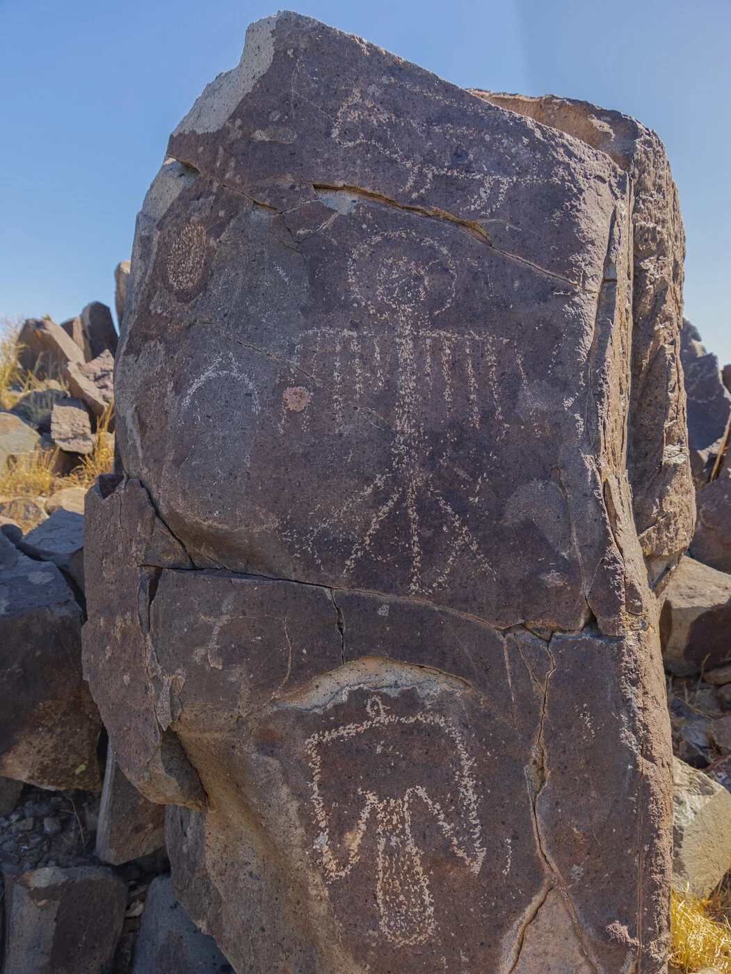
Using stone tools, the people would remove the patina on the rocks. Over 21,000 petroglyphs of birds, animals, fish, people, masks, sunbursts, hand and foot prints, geometric designs, and other creations of stories and imaginations where created in the half millennium the Jornada Mogollon lived here.


The Sierra Blanca and Sacramento Mountains form the eastern side of the Tularosa Basin. Thirty to sixty miles to the west rise the the San Andres and Oscura Mountains, and the basin stretches 150 miles north to south. This is an endorheic basin meaning what little rain falls does not flow out of the basin. Some water to the south accumulates in playas which evaporate forming gypsum crystals which in turn blow to form white sand dunes which you can see in the distance. If you were standing here nearly 76 years ago to the day, you would have seen the mushroom cloud rising over the Trinity Site of the first nuclear explosion.

The north end of the basin had a lava flow about 500 years ago soon after the Jornada Mogollon people left. In the image below you can barely see the black streaks of lava forming the Malpais. In future blog posts there’ll be images from White Sands and the Malpais.

We were the first to hike up the trail in the morning, but before we got there a roadrunner had walked most of the way up the dusty trail to the first ridge. We followed its footprints just as the Jornada Mogollon had a millennium ago.

One of the frequently shared glyphs from this Three Rivers site is the Bighorn Sheep pierced by three arrows. A thanksgiving of a hunt? A prayer for a hunt? A metaphor for some other beliefs of the people who lived here?

We know so little of these people, but they left art to let us try to enter some of their beliefs, experiences and dreams. Fortunately, this accessible site visited by thousands is respected and shows very few signs of vandalism or degradation.

What do you see?