I have various strategies when heading to a location to hike. One is using a terrific app named All Trails. The biggest advantage of All Trails is that you can download a map of the trail while you are on wifi, then while you are on a hike GPS can show where you are on trail—or more importantly, off the trail! It also links to my Garmin watch to keep a quick eye on the map.

Current River, Ozark National Scenic Riverways
Another great advantage of All Trails is that after a hike, you can add your comments and review about the trail. And before the hike, you can read others’ comments. Based on a note someone made a week before I took this hike, I was not going to take this trail. The review said a controlled burn had just occurred and most of the five plus mile hike was through burnt forest. Here comes my next—and most important—resource: a park ranger. When first arriving at Ozark National Scenic Riverways, I chatted with the ranger at the visitor center. He’d lived in the area his entire life and had a wealth of tips for my visit. I told him my interests, and among the trails he suggested was the Cave Spring Loop Trail. I said I’d read there had been a recent burn there. He described the burn, said why it was needed, and said it was still a rewarding hike with a great destination at Cave Spring. As I showed in last week’s post, he was absolutely right about the great reward at the end when you come to the Cave Spring on the Current River.

As advised, about half the hike was through an area recently burned as part of a massive effort to help restore the forest. Most of the hike was through private land, not national parkland, and a joint effort is being undertaken to improve the forest. The commonly taught myth is that most of this country was untouched wilderness before colonists tamed it. However, evidence shows that much of the land had been carefully tended by native peoples, including burning underbrush and clearing forest for meadows.

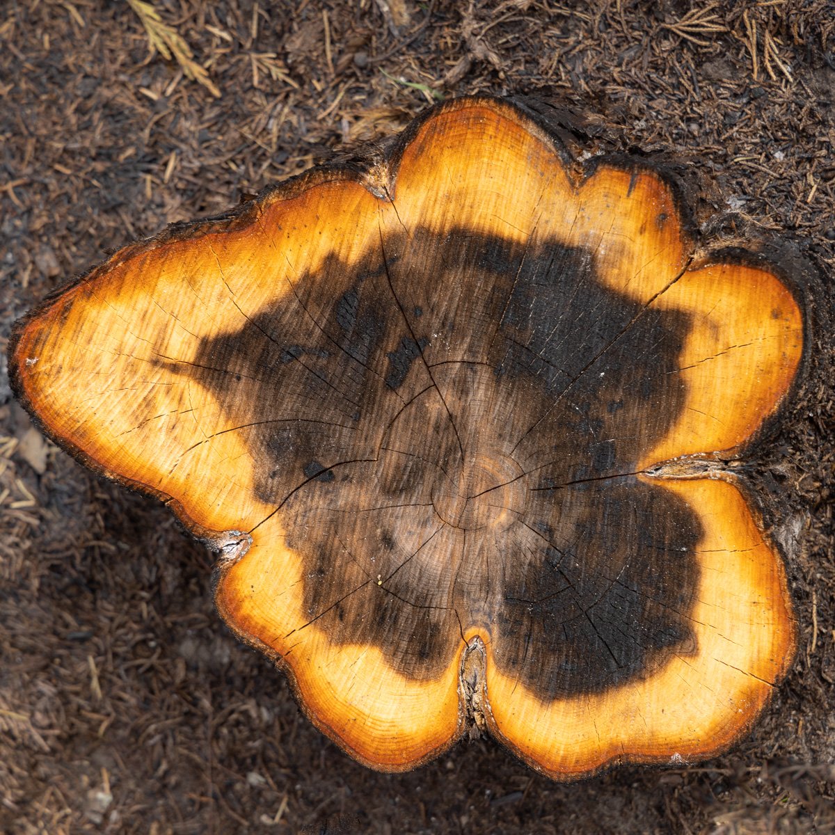
Significant work was occurring here clearing many of the trees as well as burning the underbrush. The new spring leaves were spouting on the other side of the valley. Slowing down to look at the charred wood revealed beautiful patterns in the cut stumps.
The All Trails app was still terrifically useful. The GPS positioning is extraordinary, and shows where I am on the trail, how far to the next turn on the trail to look for and the upcoming elevation gain or loss to anticipate.

The other trail guide I’ve learned to trust is Chance—the dog, not fate. I assume my knowledge as well as my viewpoint over five feet above his makes my trail finding skills much better. I have discounted his sense of smell and other trail following skills at my peril. He often will take a turn and follow a path I never saw, and I need to stop and determine if he chose the right one. He usually does. I remember on a hike in the Obed NSR where he headed off confidently down a narrow path. I called him back to get on the wider path which I was certain was the right one. About a quarter mile on, I turned around hoping to find the cut off again which had been the correct way to go. Chance found it again with no problem.

Which route?
One of the great benefits of All Trails is that if I haven’t been paying close attention, it will show me the way to get back to the right trail, or where to cut across the forest to get back to the trail, or as has been the case more than once to simply look for an alternative way to get back to where I started.
In the meantime, look down. It might appear a stump is still glowing with fire.

Google Maps just announced that they have begun developing similar features for many of the national parks, including hiking trail information and routes. Since many of the parks have limited or no cell service, you can download trails ahead of time. I’m going to try this new feature out next week during a visit to Mt. Rainier National Park. All Trails seems to have more features and covers a vastly larger number of trails, but I look forward to seeing what Google can offer.
In the meantime, it’s also important to look down. You might be surprised at a sign a forest worker left behind.
