I recently posted some images from Curecanti National Recreation Area on the Gunnison River in western Colorado. Curecanti is immediately down river from Black Canyon of the Gunnison National Park. I realized I’d never posted images of an earlier visit to that park.
Black Canyon of the Gunnison National Park, Colorado
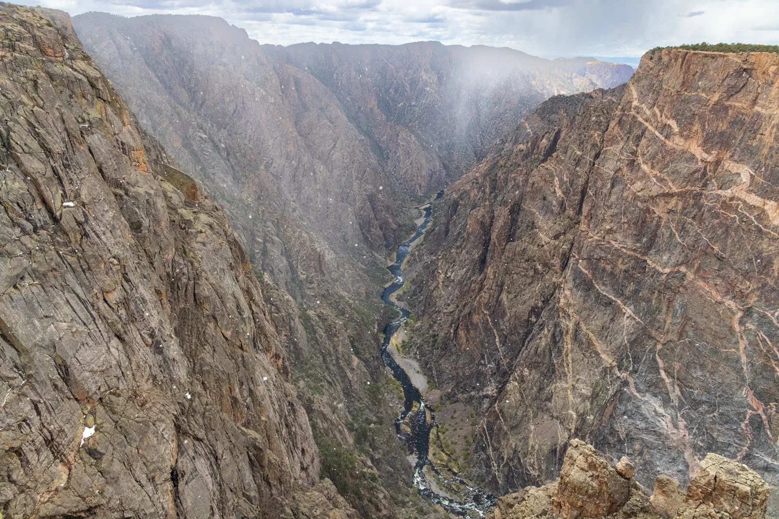
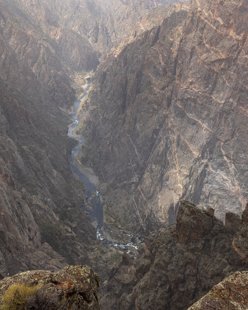
The canyon is not nearly as deep as the mile depth of the Grand Canyon or Hells Canyon in Idaho, but the canyon is narrow and dramatically steep, and 2,200 feet at the deepest.
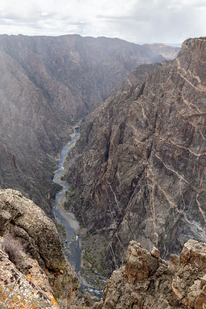
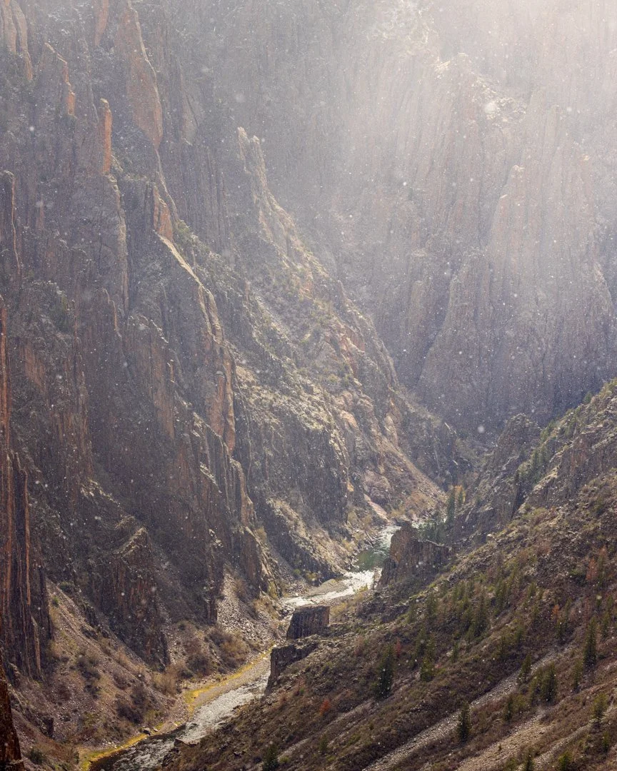
At this view the canyon is over 1,800 feet deep and only 1,100 feet across. The park is on the eastern edge of the Colorado Plateau. The uplift was also topped with volcanic debris and sandstone. Only 2 million years ago the river started quickly cutting through those softer upper layers and then down into the ancient rocks eventually reveling some of the oldest rock in the world. Look down.
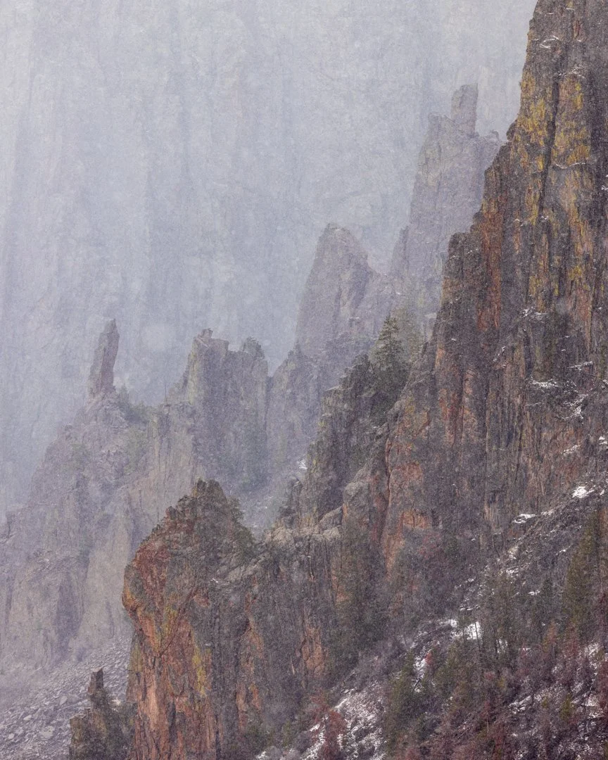
The day we visited in April a few years ago was very snowy.
I previously posted about the story of how the river got named after Captain John Gunnison who was surveying the area for a route for a transcontinental railroad. When he saw this canyon, he appropriately determined this would not be a good route. The post also explores the mystery of who soon killed Captain Gunnison—the Mormons or the Utes, both of whom did not want a railroad in the area.
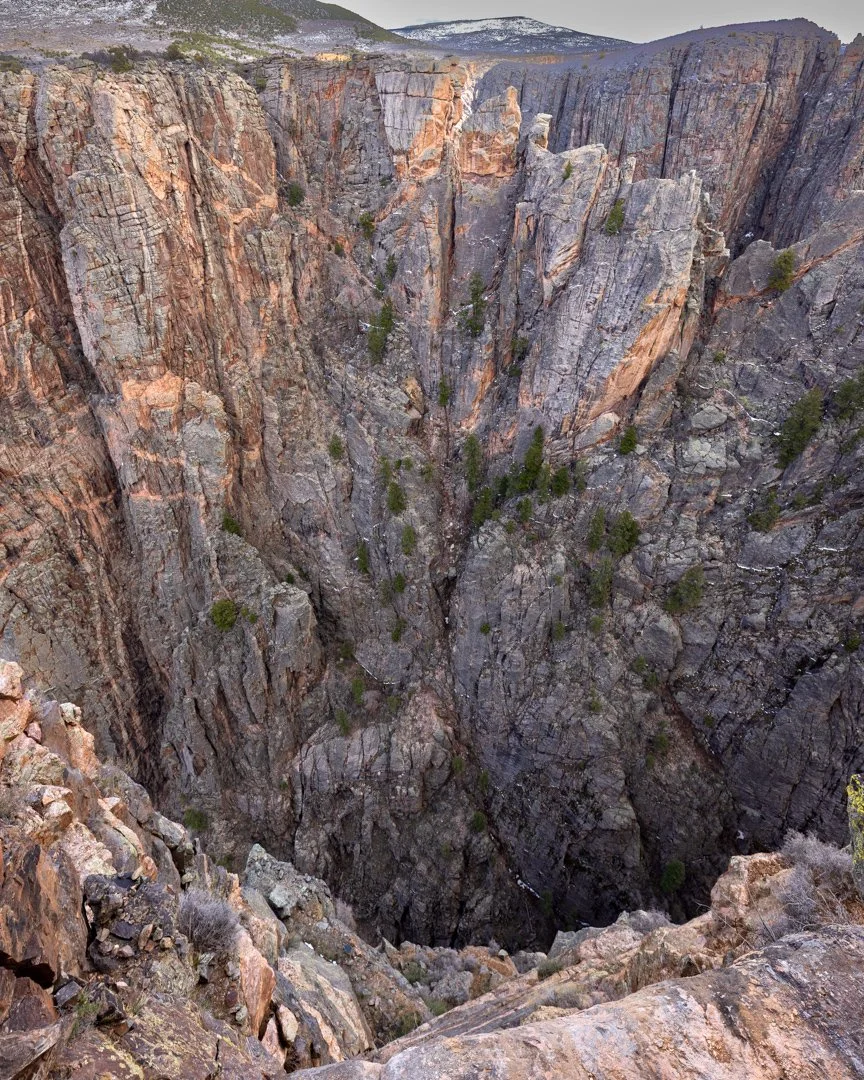
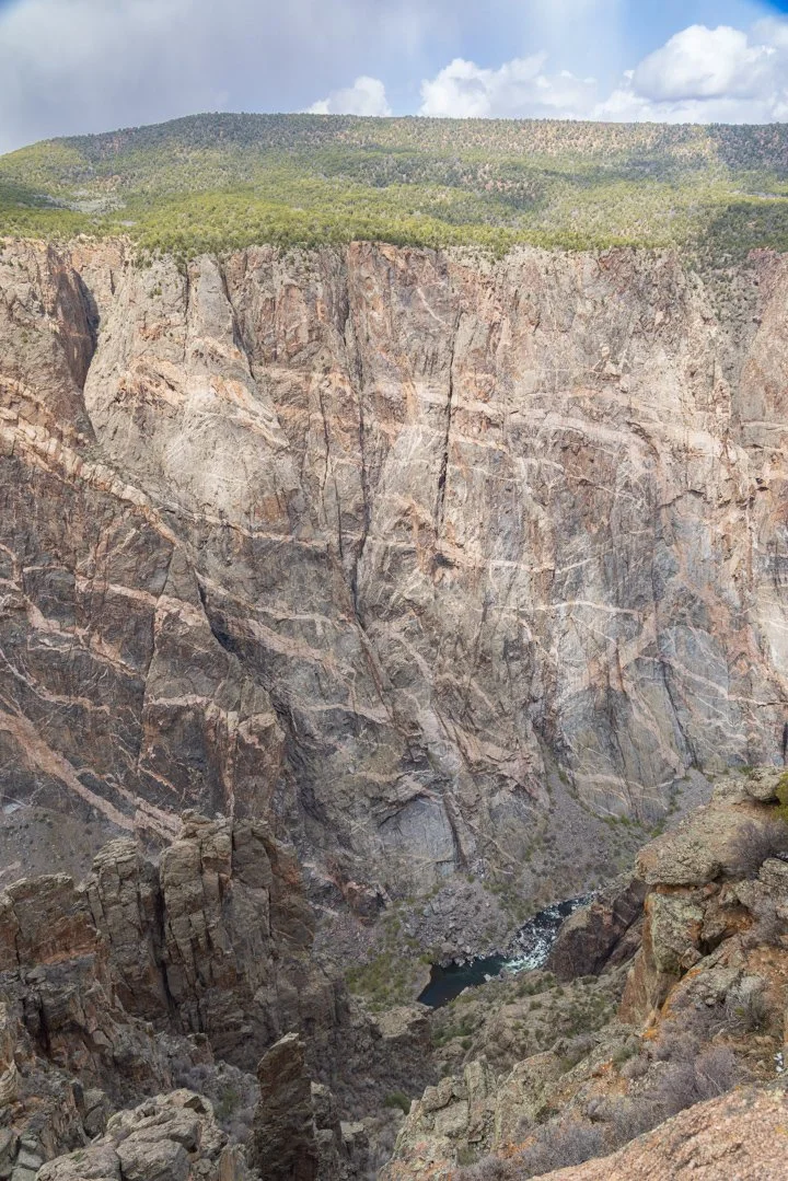
You can see how the walls of the canyon are “painted” by the igneous rock which is the cooled and hardened magma that flowed through the older gneiss and schist. The image below helps give a perspective of the size of the formations with the trees on top.
That’s all, time to glow.